Wednesday, August 7, 2013

Flat Land Finally

It was actually refreshing finally getting far enough east where we didn't have to cross any more mountains. While they are beautiful they can be stressful if your not use to driving in  them. Crossing Colorado on interstate 70 is awesome but you have two big peaks to cross, both 10,000 plus feet. We flat landers have our own  style. Once you get beyond Denver your pretty much on flat land all the way home. Our home anyway.

Even in the middle of Nebraska you can find an archway spanning the freeway.


Tuesday, August 6, 2013

More Canyon Lands


Some pictures from the Canyon Lands National Park


                                                           Rain over the Canyon Lands

                                                                   Contrasting weather


                                                                            Shafer jeep trail

                                                                         Shafer jeep trail
Shafer jeep trail


Land of color

Broken Arch
Sand Arch

Monday, August 5, 2013

Canyon Lands – Island in the Sky District


Green River Overlook


We left early this morning in hopes of getting a spot in our favorite campground. Campgrounds in National Parks fill early and can be hard to come by. We not only got a site but we got our favorite spot. We were here once before and thought this was the best spot, there are only 12 spaces available in this campground so we feel very fortunate.

 Willow River Campground

Green River Overlook


It is very hot here close to 100 but as they say it’s a dry heat and therefore more tolerable. It has rained off and on today which is very strange as this is the first rain we have had since leaving in early July. The thunder coming up from the canyons sounds awesome. Most of the day was sunshine and beautiful however as you can see in the photos.

Just down from our campsite is the overlook for the green river. The photos do not show the depth and expanse of this area, it is spectacular.

This afternoon we took a hike to one of the few areas here in the park with Indian ruins. The Indians lived in the overhangs on steep cliffs. The trail to the ruins was easy enough till the very end when we had to scale out a ways to reach the ruins.


 Trail to the grainary....don't look down
 The grainary


We then hiked another trail to Upheaval Dome. The trail ends at an overlook in which a fantastically deformed pile of rock lies below within a crater about three miles across and 1,200 feet deep. There is strong evidence that a meteorite impact caused the structure.  


Saturday, August 3, 2013

Ely Nevada and Great Basin National Park

                                                          Great Basin National Park


We arrived in Ely late Wednesday afternoon. We had wanted to stay at a casino RV park in town but they were full by the time we got there. Option two was to take a spot at a private park in town. Nothing fancy but we did have full hookups as well as cable TV and fast WIFI. We did see where 18 miles out of town was the site of the Ward Charcoal Ovens. The ovens were built about 1876 to produce charcoal for the smelter serving the gold mines in the area. The ovens were 35 feet high and would be filled with as much as 35 cords of pinon pine before they were fired. So at 7:30 pm we headed out to find the ovens.


We left Ely early Thursday morning for an easy drive to Great Basin National Park. The park has five campgrounds that are first come first serve but only one would accommodate our sized RV. We were fortunate to get in right away. We have a great spot with a running creek right outside our bedroom window. It is a very relaxing site.

One of the popular activities of Great Basin is a visit to the Lehman Cave. The cave can only be entered with a guided tour and tickets do sell out. So we went and bought tickets for the 2:00 pm tour. We have been on many cave tours and this was one of the best. 

This morning we headed out for a hike that took us to the Bristlecone Pine grove. The Bristlecone pine trees are some of the oldest living on earth. A bristlecone pine tree found here was determined to be the world’s oldest living tree at 4,950 years old. At lower elevations, where the conditions are less extreme, bristlecone pines grow faster and larger, but they die at the tender age of 300 or 400 years.   


 Wheeler Peak 13,000 feet

 Trail to Bristlecone Pine Grove
  Trail to Bristlecone Pine Grove
  Trail to Bristlecone Pine Grove

 Bristlecone Pine
  Bristlecone Pine
 Bristlecone Pine

We left Great Basin National Park this morning for Utah. We have always been drawn to Utah and were anxious to see parts of the state we have not seen before.  Although we enjoyed the California and Oregon coast and its beautiful scenery we feel Utah has the whole package, the entire state is a picture postcard.

We passed an extremely large lake, Sevier Lake, rainfall variations over time have caused this lake to fluctuate between being a dry lakebed and the state’s third largest body of water.  It wasn’t long before we were in the familiar red rock and canyons that we know as Utah. We are currently staying in Green River which is just north of Moab which is base for exploring the Arches and Canyon’s in the area. We will head into Moab in the morning.

 Sevier Lake Western Utah

Western Utah


 Scenery along interstate 70


Wednesday, July 31, 2013

Redwoods National Park, Lassen Volcanic National Park and America's Lonliest Highway


Scenic California Highway 101


Redwoods

We are camping at the Redwood National Park in Crescent City California. Today is our second and last day here. Tomorrow we leave the coast and start the long trip home. We have really enjoyed our stay on the coast despite the fog and cool weather; once we get inland I’m sure we are going to miss the cool temperatures.


After arriving yesterday we drove the scenic Howland Hill Road. This drive offers an amazing introduction to the towering old growth redwoods of the National Park. To be among such giants is very humbling.   Pictures don’t do justice as you can’t grasp the size of these trees without being next to them. Some of the trees are close to 400 feet tall and can be up to 2000 years old we took a hike through one of the oldest groves in the Park and it was just awesome plus as a bonus there are no bugs to ruin a walk in the woods.

Our next stop was Enderts Beach where we combed the beach for shells and found quite a few sand dollars even though it was later in the day and most of the beach had been picked clean already.  

 Enderts Beach Cresent City California


This morning we headed south down the California coast to Klamath the drive would have been beautiful but it was shrouded in heavy fog so we didn’t see as much as was promised but we were lucky enough to see a Bob Cat cross right in front of us and disappear into the woods. On the trip back to Crescent City we were able to take the Drive Through the Tree Tour and visit an area of tidal pools, very interesting but the tide started coming in so it was a little scary .  


 Collection of sand dollars


 Tidal Pools


Lassen Volcanic Nation Park

We are staying at a beautiful National Forest campground just outside of Lassen Volcanic National Park. We are spending two days here. Yesterday we arrived late in the afternoon and didn’t have time to see the area so this morning we left early and headed into the park. Lassen Volcanic National Park is located in northern California 50 miles east of Red Bluff and Redding. In 1914 Lassen eruption launched three years of sporadic volcanic outburst. The largest eruption was May 22nd 1915. Congress made this area a National Park in 1916.


 Bridge Creek Campground


 Creek running through our campsite


After a stop at the visitors center we headed out for a three mile hike called the Bumpass Hell Trail. This trail was easy enough to begin with, winding around the mountain side with exceptional views of lush meadows and beautiful valleys. The trail ended with a 300 foot descent to a hydrothermal area.  This area not only features a boiling spring’s lake but bubbling mud pots, steaming fumaroles and boiling water. The sulphur smell was over powering and reminded us of Yellowstone. 


                                                         Part of the Cascade Mountain Range

                                                                Trail to volcano summit

                                                            Trail to boiling springs lake


                                                                 Trail to Bumpass Hell
                                                                          Bumpass Hell


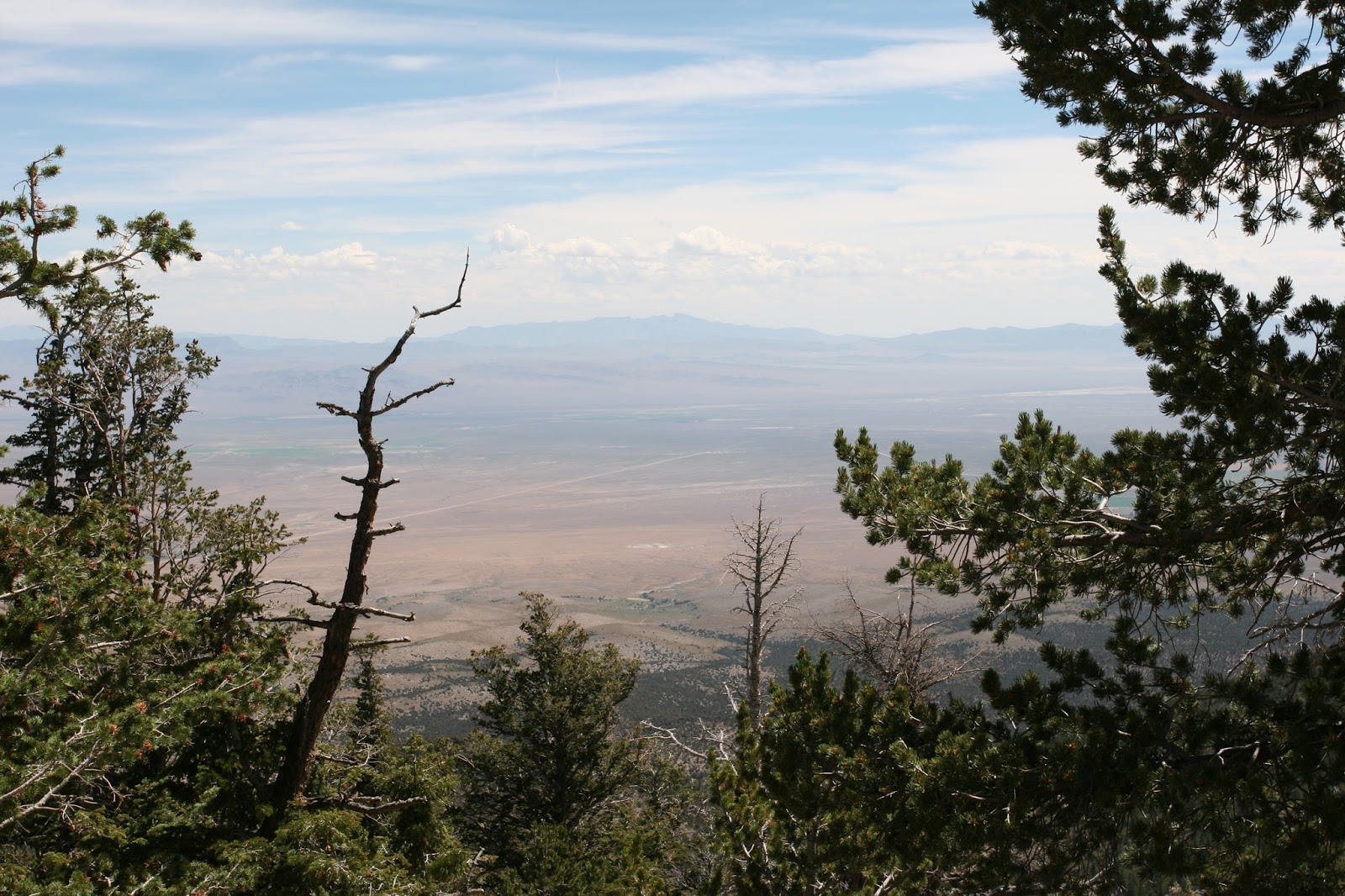
Today we are spending the night in Ely Nevada. We had a long drive on Nevada highway 50 which has been named the loneliest highway in America. If you drive this scenic highway you had better make sure your vehicle is in good working order, you have plenty of gas and plenty of water. Towns with any service are far and few between. It is a beautiful drive across the state; there are many summits that must be climbed followed by long valleys and then more summits and more valleys

                                                          Loneliest Highway in America
                                           Looking back on one of the few towns passed
                                                                    Love the clouds
                                                            Nevada's plush desert
                                                              Ranchers driveway maybe

Tomorrow we are visiting Great Basin National Park.